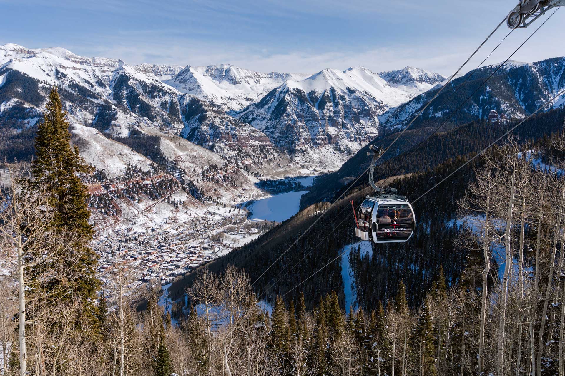
Tips For Traveling From Montrose Regional Airport To Telluride
Tips For Traveling From Montrose airport. There are a few options for reaching our unique, small town of Telluride from the Montrose Regional Airport. You generally won’t need a car in Telluride, so consider traveling by bus (approximately an hour and 15 minutes) or by shuttle/rideshare (an hour and 51 minutes). Both of these options will allow you to relax and free to enjoy the extraordinary scenery on the way to your rental in Telluride!
Driving Yourself
If you have time and a sense of adventure, you can enjoy the scenery as well as a few extras by renting a car from one of the agencies at the airport. Major car rental companies are there like Avis, Hertz and Enterprise Rent A Car. Check the weather and road reports to ensure you are prepared, willing and able to proceed by rental car.
Keep in mind that normal travel time may be affected by the weather. Be smart and bring a second set of directions with you (preferably mapped on paper) for the route you will take as you may lose cell coverage during the drive. Study the map so you have a good mental image of the trickier parts of the route. In this gorgeous but mountainous area, the roads generally don’t run straight.
What Route Should You Take?
There are two routes you may take from Montrose Airport to Telluride. One starts by heading southeast, is approximately 67.5 miles long, and takes an estimated hour and 25 minutes to drive if the weather is cooperative and your trip uneventful. The other route starts out heading southwest, is 59.6 miles long, but takes an estimated hour and 45 minutes to traverse.
To take the eastern way:
- From Montrose Airport, follow Airport Road to North Townsend Avenue.
- Turn left onto US 50 S. At Main St stay heading South on US 550.
- At Ridgway, turn right onto CO-62 W.
- Turn left at Placerville onto CO-145 S and follow it into Telluride.
To take the western way:
- From North Townsend Avenue, go to CO-90 W.
- Proceed to Dave Wood Road and turn left.
- You will follow Dave Wood Road for some time, through the edge of the Uncompahgre National Forest.
- Keep heading south (making a series of east and south turns) to 60X Road.
- Turn right onto 60X.
- At Buck Canyon, turn right onto CO-62.
- At Placerville, turn left onto CO-145 S and follow it into Telluride.
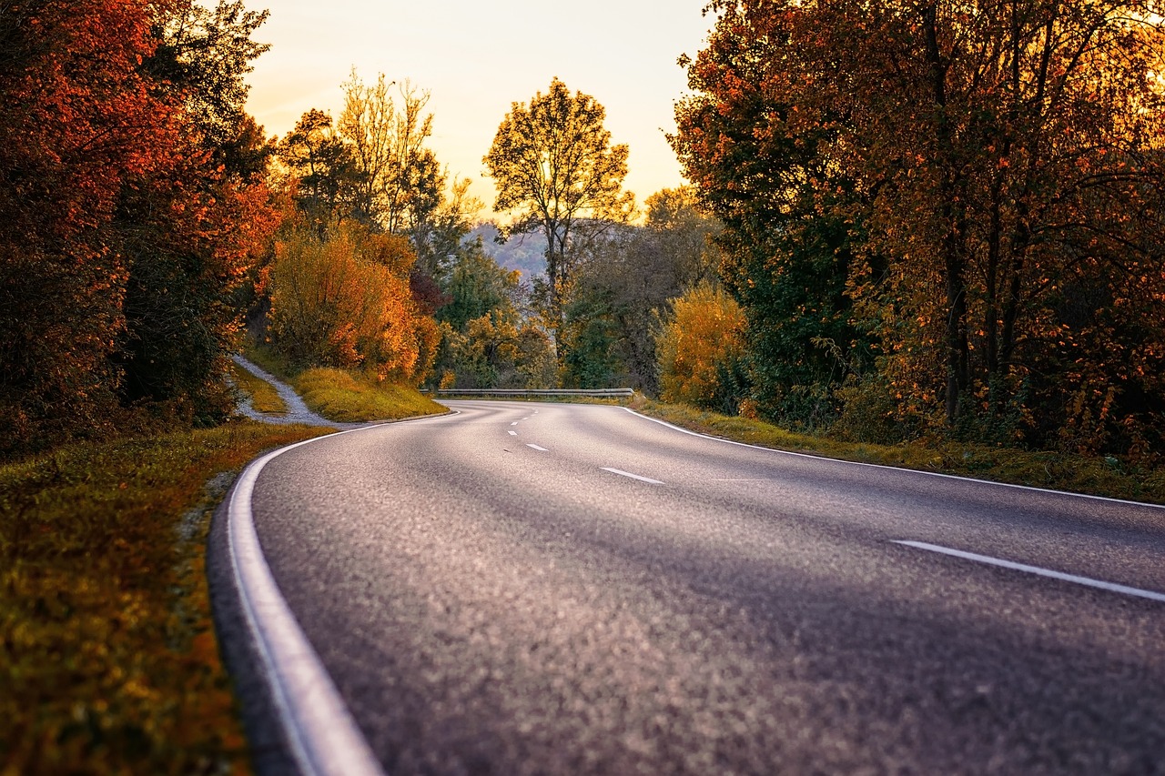
US 550, CO-62 and CO-145 are part of the San Juan Skyway Scenic Byway. Be prepared to be overwhelmed and exhilarated by some of the most beautiful scenery in the country. Drive safely, and stop the car in a safe place before getting out your camera!
Things to See or Do Along the Western Way
Driving through an edge of the Uncompahgre National Forest—just a small part of the Forest’s 955,229 acres on the slopes of the Rockies — you’ll cross several creeks and get a real sense of the terrain. If it isn’t winter and you feel adventurous, you might stop to try one of the hiking trails. This area has terrific views.
Make sure you are conditioned for a hike and well-prepared with water and a trail map. As for any hike, know where you’re going and what your limits are. If you aren’t from a place of altitude, remember that the air may feel “thin.”
At Placerville, turn onto CO-145 S. Placerville started as a gold-mining camp in the late 1800s, and subsequently mined vanadium. Along CO-145 S you will pass through tiny Sawpit. Originally established to produce lumber for the Rio Grande Southern Railroad, as of the 2000 census Sawpit had a population of 25. Past Sawpit, continue into the San Juan National Forest and straight to Telluride.
Things to See or Do Along the Eastern Way
Traveling US 550 S, you’ll come across a few scenic towns. Colona, homesteaded in the 1880s, is 10 minutes from Montrose. Colona has several historic buildings for which you might want to stop. Farm country here is surrounded by high mountain ridges, with US 550 running in a narrow valley alongside the Uncompahgre River. The views are incomparable.
The River winds to the other side of US-550. Look for stunning manmade Ridgway Reservoir on your right, filled just in 1990. CO-62 W will take you right through the heart of Ridgway, which has a designated Creative Arts District; the Orvis Hot Springs; a regional Railroad Museum; and a Ranch History Museum.
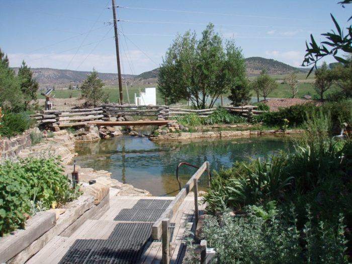
Photo Credit: Joe Grasso via Flickr CC2.0
Passing through or visiting Ridgway, you may notice an Old West feeling as well as buildings and props leftover from the many films made in the area (most famously, True Grit). Once through Ridgway, CO-62 W eventually meets up with CO-145 S at Placerville. Turn left onto CO-145 and drive straight to Telluride.
Something For Another Day
If you’d continued south on US 550, bypassing Ridgway, you would have ended up in Ouray, home of the Ouray Hot Springs, the Wiesbaden Hot Springs and vapor caves, and the Ouray Ice Park. Further south is the ghost town of Ironton, a thriving mining town until the 1940s. Head down the stretch of road called the Million Dollar Highway, and enjoy scenery that includes old mine buildings packed against the slopes. You can view our guide to Telluride area hot springs here to check out the full list of options.